

Clicking the Scan Recon button will launch Scan Recon and will also bring you back to your coordination:
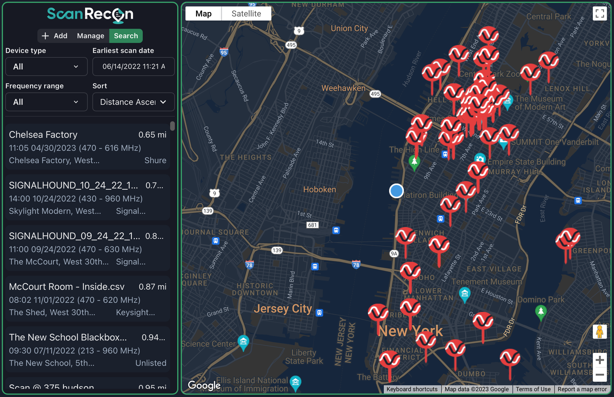
- Scan Recon is the utility to search for, manage, and upload scans to the Coord Database.
- By default when you launch it for the first time in a project it will search your location and show you any scans in the area.
- Scans are displayed on the map and also a list to the left.
- You can change search parameters to filter by device, and frequency range
- You can also limit the age of the oldest result and sort by distance, date or device type
- After selecting a scan you will see this window:
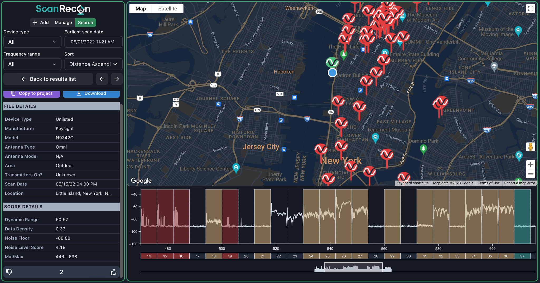
- You will see file details on the left with options to copy it to your project or download as a CSV.
- copy to project will make it available in your Plot Area.
- The lower left area lets you upvote or downvote the scan for other users to see.